


Preah Vihear Temple
From Wikipedia, the free encyclopedia
Preah Vihear Temple or Prasat Preah Vihear or Temple of Preah Vihear (Khmer: ប្រាសាទព្រះវិហារ, Thai: ปราสาทเขาพระวิหาร, Prasat Preah Vihear) is a Khmer temple situated atop a 525-metre (1,722 ft) cliff in the Dângrêk Mountains, in the Preah Vihear province of northern Cambodia and on the border of Kantharalak district (amphoe) in Sisaket province of eastern Thailand. In 1962, following a lengthy dispute between Thailand and Cambodia over ownership, a majority of the International Court of Justice (ICJ) in The Hague awarded the temple to Cambodia.
Affording a view for many kilometers across a plain, Prasat Preah Vihear has the most spectacular setting of all the temples built during the six-centuries-long Khmer Empire. As a key edifice of the empire's spiritual life, it was supported and modified by successive kings and so bears elements of several architectural styles. Preah Vihear is unusual among Khmer temples in being constructed along a long north-south axis, rather than having the conventional rectangular plan with orientation toward the east, and was obviously built to serve the region to the north. The temple gives its name to Cambodia's Preah Vihear province, in which it is now located, as well as the Khao Phra Wihan National Park which borders it in Thailand's Sisaket province and through which the temple is most easily accessible. On July 7, 2008, Preah Vihear was listed as a UNESCO World Heritage Site.[1]
Nomenclature
Preah Vihear is transliterated into Thai as Prasat Phra Viharn (ปราสาทพระวิหาร) or Prasat Khao Phra Viharn (ปราสาทเขาพระวิหาร) [In Thai the"Ph" is pronounced simply "p"]. Prasat (ប្រាសាទ) has the same meaning in Khmer,Thai, and Sanskrit ("castle", sometimes "temple"; in Sanskrit प्रासाद), and Khao is the Thai word for "hill" or "mountain" (in Khmer: "phnom" (ភ្នំ), Cambodians occasionally refer to "Phnom Preah Vihear" (ភ្នំព្រះវិហារ) as Thais usually refer to "Khao Phra Viharn"). The words "Preah" (ព្រះ) and "Phra" (พระ) mean "sacred", and the words "Vihear" (វិហារ)/"Viharn" (วิหาร) mean "shrine" (the central structure of the temple). In Thai, the word "khao" (เขา) has recently (as of 2008) been omitted from the name in order to differentiate between the temple and the cliff it is built on. Thai mass media appear to have begun this convention. The word Vihear could be related to the Sanskrit word Vihara (विहार) which means "abode."
The two versions of the name carry significant political and national connotations (see below: New dispute over ownership).
Location
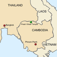
The temple sits atop Pey Tadi, a cliff in the Dângrêk Mountains which straddle the border between Thailand and Cambodia. During different periods it has been located in Cambodia and Thailand in turn. Following Cambodian independence and the Thai occupation of the temple, it was listed as being in Bhumsrol village of Bueng Malu sub-district (now merged with Sao Thong Chai sub-district), in Kantharalak district of the Sisaket province of eastern Thailand. It is 110 km from the Mueang Si Sa Ket district, the center of Si Sa Ket province.
After the 1962 ICJ majority ruled that it belonged to Cambodia, it was listed as being in Svay Chrum Village, Kan Tout Commune, in Choam Khsant District of Preah Vihear province of northern Cambodia. The temple is 140 km from Angkor Wat and 320 km from Phnom Penh. [2]
Ancient history
Construction of the first temple on the site began in the early 9th century; both then and in the following centuries it was dedicated to the Hindu god Shiva in his manifestations as the mountain gods Sikharesvara and Bhadresvara. The earliest surviving parts of the temple, however, date from the Koh Ker period in the early 10th century, when the empire's capital was at the city of that name. Today, elements of the Banteay Srei style of the late 10th century can be seen, but most of the temple was constructed during the reigns of the Khmer kings Suryavarman I (1002 -1050) and Suryavarman II (1113 -1150). An inscription found at the temple provides a detailed account of Suryavarman II studying sacred rituals, celebrating religious festivals and making gifts, including white parasols, golden bowls and elephants, to his spiritual advisor, the aged Brahman Divakarapandita. The Brahman himself took an interest in the temple, according to the inscription, donating to it a golden statue of a dancing Shiva.[citation needed] In the wake of the decline of Hinduism in the region the site was converted to use by Buddhists.
International dispute over ownership
In modern times, Prasat Preah Vihear was rediscovered by the outside world and became subject of an emotional dispute between Thailand and the newly independent Cambodia.
In 1904, Siam and the French colonial authorities ruling Cambodia formed a joint commission to demarcate their mutual border. In the vicinity of the temple, the group was tasked by the two governments to work under the principle that the border would follow the watershed line of the Dângrêk mountain range, which places nearly all of Preah Vihear temple on Thailand's side. In 1907, after survey work, French officers drew up a map to show the border’s location. However, the resulting topographic map, which was sent to Siamese authorities and used in the 1962 (ICJ) ruling, showed the line deviating from the watershed without explanation in the Preah Vihear area, placing all of the temple on the Cambodian side.
"It was clear from the record, however, that the maps were communicated to the Siamese Government as purporting to represent the outcome of the work of delimitation; since there was no reaction on the part of the Siamese authorities, either then or for many years, they must be held to have acquiesced. The maps were moreover communicated to the Siamese members of the Mixed Commission, who said nothing, to the Siamese Minister of the Interior, Prince Damrong, who thanked the French Minister in Bangkok for them, and to the Siamese provincial governors, some of whom knew of Preah Vihear. If the Siamese authorities accepted the Annex I map without investigation, they could not now plead any error vitiating the reality of their consent.
The Siamese Government and later the Thai Government had raised no query about the Annex I map prior to its negotiations with Cambodia in Bangkok in 1958. But in 1934-1935 a survey had established a divergence between the map line and the true line of the watershed, and other maps had been produced showing the Temple as being in Thailand. Thailand had nevertheless continued also to use and indeed to publish maps showing Preah Vihear as lying in Cambodia. Moreover, in the course of the negotiations for the 1925 and 1937 Franco-Siamese Treaties, which confirmed the existing frontiers, and in 1947 in Washington before the Franco-Siamese Conciliation Commission, it would have been natural for Thailand to raise the matter: she did not do so. The natural inference was that she had accepted the frontier at Preah Vihear as it was drawn on the map, irrespective of its correspondence with the watershed line.[3]"
In 1954, Thai forces occupied the temple following the withdrawal of French troops from Cambodia. Cambodia protested and in 1959 asked the International Court of Justice to rule that the temple and the surrounding land lay in Cambodian territory. The case became a volatile political issue in both countries. Diplomatic relations were severed, and threats of force were voiced by both governments.
The court proceedings focused not on questions of cultural heritage or on which state was the successor to the Khmer Empire, but rather on Siam's long-time acceptance of the 1907 map.
Arguing in the Hague for Cambodia was former U.S. secretary of state Dean Acheson, while Thailand’s legal team included a former British attorney general, Sir Frank Soskice. Cambodia contended that the map showing the temple as being on Cambodian soil was the authoritative document. Thailand argued that the map was invalid, was not an official document of the border commission, and violated the commission’s working principle that the border would follow the watershed line, which would place most of the temple in Thailand. If Thailand had not protested the map earlier, the Thai side said, it was because Thai authorities had had actual possession of the temple for some period of time, due to the great difficulty of scaling the steep hillside from the Cambodian side, or simply had not understood that the map was wrong.
On June 15, 1962, the court ruled 9 to 3 that the temple belonged to Cambodia and, by a vote of 7 to 5, that Thailand must return any antiquities such as sculptures that it had removed from the temple. In its decision, the court noted that in over the five decades after the map was drawn, the Siamese/Thai authorities had not objected in various international forums to its depiction of the temple’s location. Nor did they object when a French colonial official received the Siamese scholar and government figure Prince Damrong at the temple in 1930. Thailand had accepted and benefited from other parts of the border treaty, the court ruled. With these and other acts, it said, Thailand had accepted the map and therefore Cambodia was now the owner of the temple. [4]
The minority on the court however wrote a scathing dissent, Australian justice Sir Percy Spender saying:
Whether the Mixed Commission did or did not delimit the Dangrek, the truth, in my opinion, is that the frontier line on that mountain range is today the line of the watershed.
The Court however has upheld a frontier line which is not the line of the watershed, one which in the critical area of the Temple is an entirely different one. This finds its justification in the application of the concepts of recognition or acquiescence.
With profound respect for the Court, I am obliged to Say that in my judgment, as a result of a misapplication of these concepts and an inadmissible extension of them, territory, the sovereignty in which, both by treaty and by the decision of the body appointed under treaty to determine the frontier line, is Thailand's, now becomes vested in Cambodia.[5]
Thailand reacted angrily. It announced it would boycott meetings of the Southeast Asia Treaty Organization, with Thai officials saying this step was to protest a U.S. bias toward Cambodia in the dispute. As evidence, Thai officials cited the pro-Cambodia vote of an American judge on the court and Acheson’s role as Cambodia’s advocate; the U.S. government replied that Acheson was merely acting as a private attorney, engaged by Cambodia. Mass demonstrations were staged in Thailand protesting the ruling.
Thailand eventually backed down and agreed to turn the site over to Cambodia. Rather than lower the Thai national flag that had been flying at the temple, Thai soldiers dug up and removed the pole with it still flying.[6] The pole was erected at Mor I Daeng cliff, where it is still in use. In January 1963, Cambodia formally took possession of the site in a ceremony attended by around 1,000 people, many of whom had made the arduous climb up the cliff from the Cambodian side. Prince Sihanouk, Cambodia’s leader, bounded up the cliff in less than an hour, then made offerings to Buddhist monks. He made a gesture of conciliation in the ceremony, announcing that all Thais would be able to visit the temple without visas, and that Thailand was free to keep any antiquities it may have taken away from the site.[7]
[edit]Civil war
Civil war began in Cambodia in 1970; the temple's location high atop a cliff served to make it readily defensible militarily. Soldiers loyal to the Lon Nol government in Phnom Penh continued to hold it long after the plain below fell to communist forces. Tourists were able to visit from the Thai side during the war.
Even though the Khmer Rouge captured Phnom Penh in April 1975, the FANK soldiers at Preah Vihear continued to hold out after the collapse of the Khmer Republic government. The Khmer Rouge made several unsuccessful attempts to capture the temple, then finally succeeded on May 22, 1975 by shelling the cliff, scaling it and routing the defenders, Thai officials reported at the time.[8] It was said to be the last place in Cambodia to fall to the Khmer Rouge.
Full-scale war began again in Cambodia in December 1978 when the Vietnamese army invaded to overthrow the Khmer Rouge. Khmer Rouge troops retreated to border areas. In January, the Vietnamese reportedly attacked Khmer Rouge troops holed up in the temple, but there were no reports of damage to it. Large numbers of Cambodian refugees entered Thailand after the invasion. Guerilla warfare continued in Cambodia through the 1980s and well into the 1990s, hampering access to Preah Vihear. The temple opened briefly to the public in 1992, only to be re-occupied the following year by Khmer Rouge fighters. In December 1998, the temple was the scene of negotiations by which several hundred Khmer Rouge soldiers, said to be the guerrilla movement's last significant force, agreed to surrender to the Phnom Penh government.[9]
The temple opened again to visitors from the Thai side at the end of 1998; Cambodia completed the construction of a long-awaited access road up the cliff in 2003.
